


CYEP - Edmonton Parkland Executive Airport
Located in Edmonton, Canada
ICAO - , IATA -
Data provided by AirmateGeneral information
Coordinates: N53°28'27" W113°49'27"
Elevation is 2330 feet MSL.
Magnetic variation is 14° East View others Airports in Ontario
Operational data
Special qualification required
Current time UTC:
Current local time:
Communications frequencies: [VIEW]
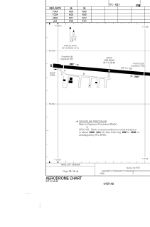
Runways:
| RWY identifier | QFU | Length (ft) | Width (ft) | Surface | LDA (ft) |
| 08 | 95° | 3681 | 102 | CONC | 4732 |
| 26 | 275° | 3681 | 102 | CONC | 4181 |
Airport contact information
Address: Edmonton Canada