


DTTA - Tunis/Carthage
Located in Tunis, Tunisia
ICAO - DTTA, IATA - TUN
Data provided by AirmateGeneral information
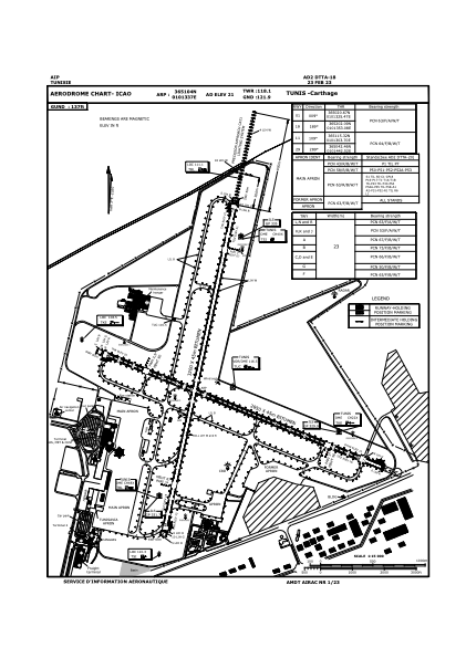
Coordinates: N36°51'4" E10°13'37"
Elevation is 21 feet MSL.
Magnetic variation is 3° East View others Airports in Tunis Governorate
Operational data
Special qualification required
Current time UTC:
Current local time:
Communications frequencies: [VIEW]
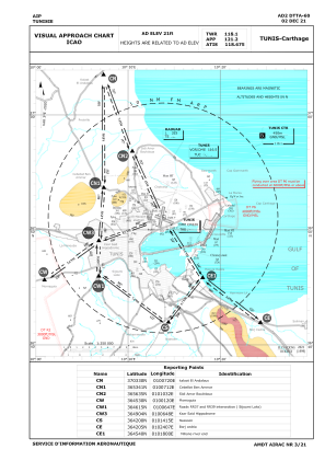
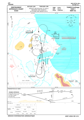
Runways:
| RWY identifier | QFU | Length (ft) | Width (ft) | Surface | LDA (ft) |
| 11 | 112° | 9350 | 148 | ASP | |
| 29 | 292° | 9350 | 148 | ASP | |
| 01 | 12° | 10499 | 148 | ASP | |
| 19 | 192° | 10499 | 148 | ASP |
Airport contact information
Address: Tunis Tunisia