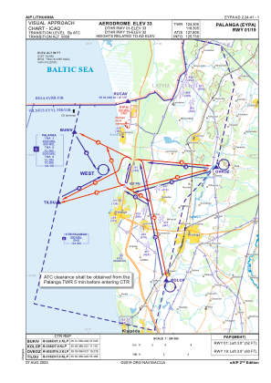
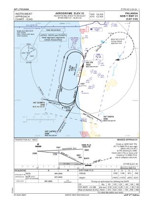
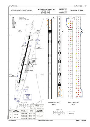


EYPA - Palanga/International
Located in Palanga, Lithuania
ICAO - EYPA, IATA - PLQ
Data provided by AirmateGeneral information
Coordinates: N55°58'23" E21°5'38"
Elevation is 33 feet MSL.
Magnetic variation is 6° East View others Airports in Klaipeda County
Operational data
Special qualification required
Current time UTC:
Current local time:
Communications frequencies: [VIEW]
Runways:
| RWY identifier | QFU | Length (ft) | Width (ft) | Surface | LDA (ft) |
| 01 | 13° | 7480 | 148 | ASPH | 6988 |
| 19 | 193° | 7480 | 148 | ASPH | 6988 |
Airport contact information
Address: Palanga Lithuania