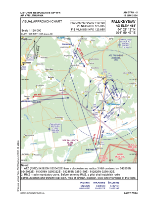

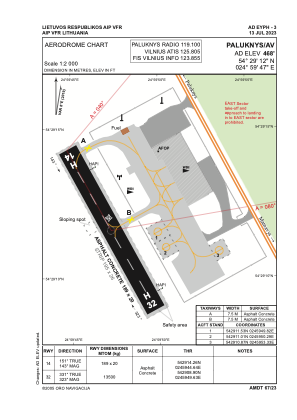


EYPH - Paluknys/Av
Located in Paluknys, Lithuania
ICAO - , IATA -
Data provided by AirmateGeneral information
Coordinates: N54°29'12" E24°59'47"
Elevation is 468 feet MSL.
Magnetic variation is 8° East View others Airports in Vilnius County
Operational data
Special qualification required
Current time UTC:
Current local time:
Communications frequencies: [VIEW]
Runways:
| RWY identifier | QFU | Length (ft) | Width (ft) | Surface | LDA (ft) |
| 14 | 0° | 620 | 66 | UNK | |
| 32 | 0° | 620 | 66 | UNK |
Airport contact information
Address: Paluknys Lithuania