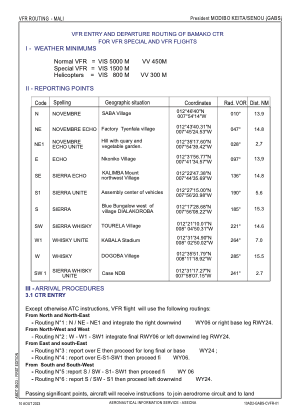
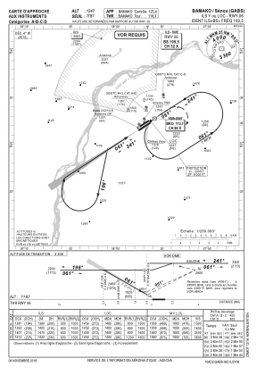
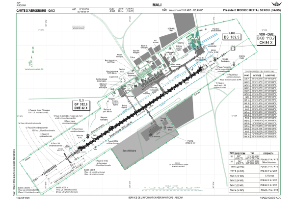


GABS - Aeroport International President Modibo Keita-Senou
Located in Bamako, Mali
ICAO - GABS, IATA - BKO
Data provided by AirmateGeneral information
Coordinates: N12°32'16" W7°56'35"
Elevation is 1247 feet MSL.
View others Airports in Koulikoro
Operational data
Special qualification required
Current time UTC:
Current local time:
Communications frequencies: [VIEW]
Runways:
| RWY identifier | QFU | Length (ft) | Width (ft) | Surface | LDA (ft) |
| 06 | 57° | 10499 | 148 | ASP | |
| 24 | 237° | 10499 | 148 | ASP |
Airport contact information
Address: Bamako Mali