


IL48 - St Louis Metro-East/Shafer Fld
Located in St Jacob, United States
ICAO - IL48, IATA -
Data provided by AirmateGeneral information
Coordinates: N38°43'58" W89°48'24"
Elevation is 477 feet MSL.
Magnetic variation is -02° East View others Airports in Illinois
Operational data
Special qualification required
Current time UTC:
Current local time:
Communications frequencies: [VIEW]
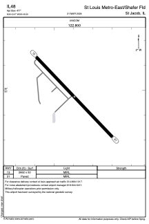
Runways:
| RWY identifier | QFU | Length (ft) | Width (ft) | Surface | LDA (ft) |
| 13 | 136° | 2662 | 50 | ASPH | |
| 31 | 316° | 2662 | 50 | ASPH |
Airport contact information
Address: St Jacob United States