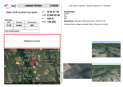


LF6539 - Labatut Rivière
Located in Labatut-Rivière, France
ICAO - , IATA -
Data provided by AirmateGeneral information
Coordinates: N43°31'16" E0°2'5"
Elevation is 534 feet MSL.
View others Airports in Midi-Pyrénées
Operational data
Special qualification required
Current time UTC:
Current local time:
Communications frequencies: [VIEW]
Runways:
| RWY identifier | QFU | Length (ft) | Width (ft) | Surface | LDA (ft) |
| 17 | 0° | 738 | 0 | GRASS | |
| 35 | 0° | 738 | 0 | GRASS |
Airport contact information
Address: Labatut-Rivière France