
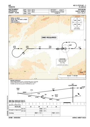
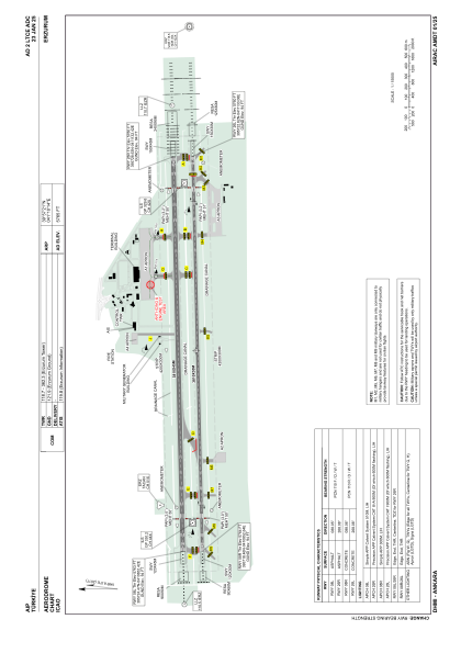


LTCE - Erzurum
Located in Erzurum, Turkey
ICAO - LTCE, IATA - ERZ
Data provided by AirmateGeneral information
Coordinates: N39°57'21" E41°10'14"
Elevation is 5765 feet MSL.
Magnetic variation is 6.0° East View others Airports in Erzurum
Operational data
Special qualification required
Current time UTC:
Current local time:
Communications frequencies: [VIEW]
Runways:
| RWY identifier | QFU | Length (ft) | Width (ft) | Surface | LDA (ft) |
| 08L | 88° | 12500 | 148 | ASPH | 12500 |
| 26R | 268° | 12500 | 148 | ASPH | 12500 |
| 08R | 88° | 12500 | 98 | CONC | 12500 |
| 26L | 268° | 12500 | 98 | CONC | 12500 |
Airport contact information
Address: Erzurum Turkey