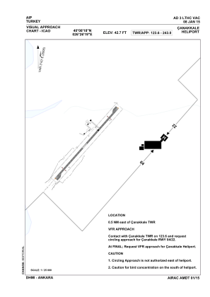

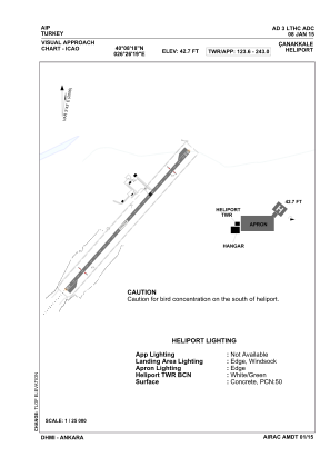


LTHC - Canakkale Military Heliport
Located in Canakkale, Turkey
ICAO - , IATA -
Data provided by AirmateGeneral information
Coordinates: N40°8'18" E26°26'19"
Elevation is 42 feet MSL.
Magnetic variation is 3.43° East View others Airports in Çanakkale
Operational data
Special qualification required
Current time UTC:
Current local time:
Communications frequencies: [VIEW]
Runways:
Airport contact information
Address: Canakkale Turkey