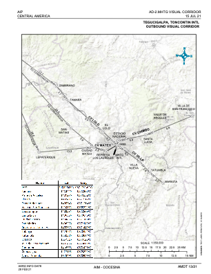
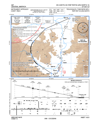
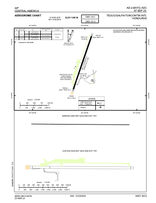


MHTG - Toncontin
Located in Tegucigalpa, Honduras
ICAO - MHTG, IATA - TGU
Data provided by AirmateGeneral information
Coordinates: N14°3'37" W87°13'3"
Elevation is 3307 feet MSL.
View others Airports in Francisco Morazan
Operational data
Special qualification required
Current time UTC:
Current local time:
Communications frequencies: [VIEW]
Runways:
| RWY identifier | QFU | Length (ft) | Width (ft) | Surface | LDA (ft) |
| 02 | 19° | 6631 | 148 | ASP | |
| 20 | 199° | 6631 | 148 | ASP |
Airport contact information
Address: Tegucigalpa Honduras