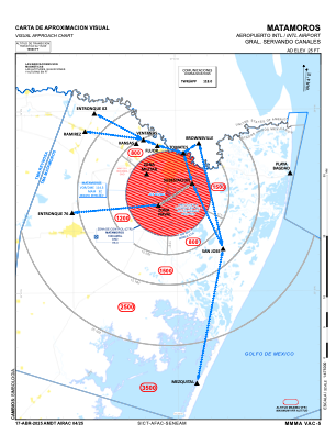
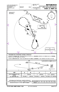
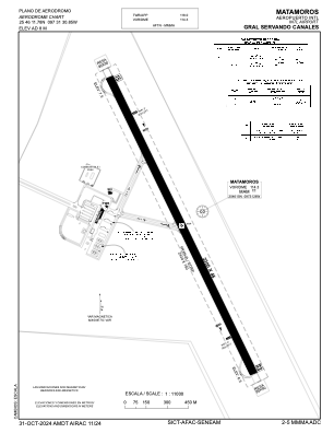


MMMA - Matamoros Aeropuerto Internacional Gral. Servando Canales
Located in Matamoros, Mexico
ICAO - MMMA, IATA - MAM
Data provided by AirmateGeneral information
Coordinates: N25°46'12" W97°31'31"
Elevation is 25 feet MSL.
View others Airports in Tamaulipas
Operational data
Special qualification required
Current time UTC:
Current local time:
Communications frequencies: [VIEW]
Runways:
| RWY identifier | QFU | Length (ft) | Width (ft) | Surface | LDA (ft) |
| 15 | 156° | 7546 | 148 | ASP | |
| 33 | 336° | 7546 | 148 | ASP |
Airport contact information
Address: Matamoros Mexico