


NE67 - Falk Air Fld
Located in Hoskins, United States
ICAO - NE67, IATA -
Data provided by AirmateGeneral information
Coordinates: N42°6'28" W97°20'29"
Elevation is 1710 feet MSL.
View others Airports in Nebraska
Operational data
Special qualification required
Current time UTC:
Current local time:
Communications frequencies: [VIEW]
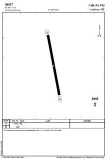
Runways:
| RWY identifier | QFU | Length (ft) | Width (ft) | Surface | LDA (ft) |
| 17 | 170° | 1795 | 75 | GRASS | |
| 35 | 350° | 1795 | 75 | GRASS |
Airport contact information
Address: Hoskins United States