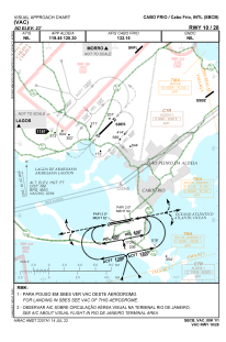
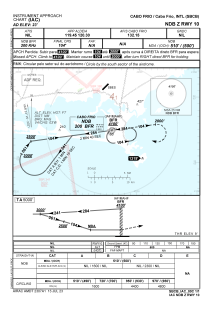
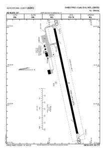


SBCB - Cabo Frio
Located in Cabo Frio, Brazil
ICAO - SBCB, IATA - CFB
Data provided by AirmateGeneral information
Coordinates: S22°55'15" W42°4'17"
Elevation is 23 feet MSL.
Magnetic variation is -23.333333333° East View others Airports in Rio de Janeiro
Operational data
Special qualification required
Current time UTC:
Current local time:
Communications frequencies: [VIEW]
Runways:
| RWY identifier | QFU | Length (ft) | Width (ft) | Surface | LDA (ft) |
| 10 | 78° | 8760 | 919 | ASPH | |
| 28 | 257° | 8760 | 919 | ASPH |
Airport contact information
Address: Cabo Frio Brazil