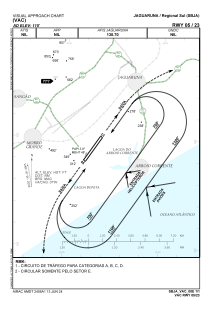
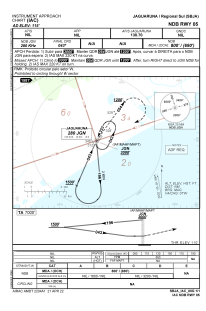
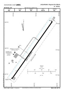


SBJA - Regional Sul
Located in Jaguaruna, Brazil
ICAO - SBJA, IATA -
Data provided by AirmateGeneral information
Coordinates: S28°40'31" W49°3'37"
Elevation is 114 feet MSL.
Magnetic variation is -19.483333333° East View others Airports in Santa Catarina
Operational data
Special qualification required
Current time UTC:
Current local time:
Communications frequencies: [VIEW]
Runways:
| RWY identifier | QFU | Length (ft) | Width (ft) | Surface | LDA (ft) |
| 05 | 0° | 8593 | 984 | ASPH | |
| 23 | 0° | 8593 | 984 | ASPH |
Airport contact information
Address: Jaguaruna Brazil