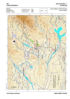
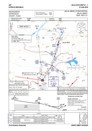
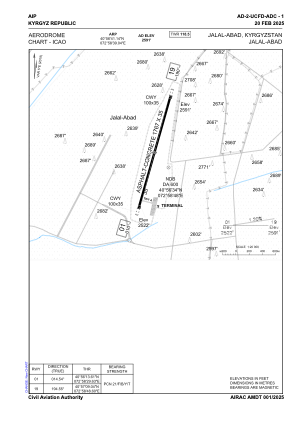


UCFD - Jalal-Abad
Located in Jalal-Abad, Kyrgyzstan
ICAO - , IATA -
Data provided by AirmateGeneral information
Coordinates: N40°56'41" E72°58'39"
Elevation is 2591 feet MSL.
Magnetic variation is +5° East View others Airports in Jalal-Abad
Operational data
Special qualification required
Current time UTC:
Current local time:
Communications frequencies: [VIEW]
Runways:
| RWY identifier | QFU | Length (ft) | Width (ft) | Surface | LDA (ft) |
| 01 | 15° | 5797 | 115 | CONC+ASPH | 5797 |
| 19 | 195° | 5797 | 115 | CONC+ASPH | 5797 |
Airport contact information
Address: Jalal-Abad Kyrgyzstan