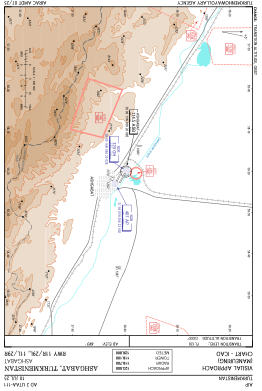
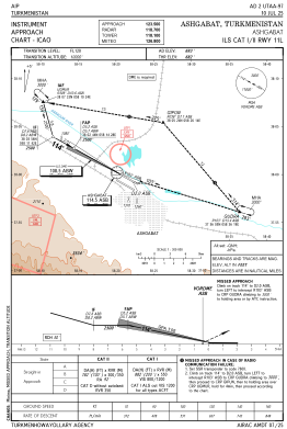
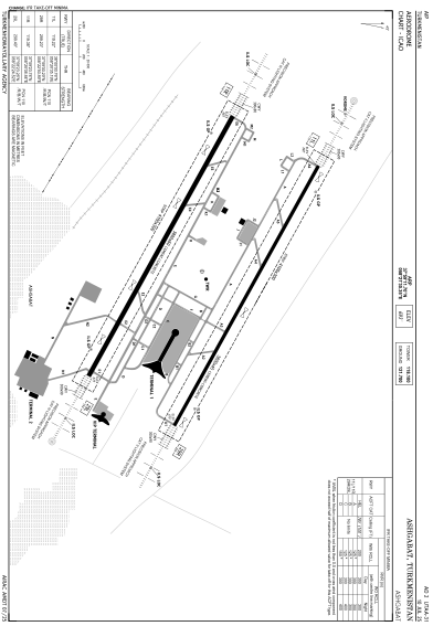


UTAA - Ashgabat
Located in Ashgabat, Turkmenistan
ICAO - UTAA, IATA - ASB
Data provided by AirmateGeneral information
Coordinates: N37°59'12" E58°21'30"
Elevation is 693 feet MSL.
View others Airports in Ahal
Operational data
Special qualification required
Current time UTC:
Current local time:
Communications frequencies: [VIEW]
Runways:
| RWY identifier | QFU | Length (ft) | Width (ft) | Surface | LDA (ft) |
| 11L | 119° | 12467 | 148 | UNK | |
| 29R | 299° | 12467 | 148 | UNK | |
| 11R | 120° | 12467 | 197 | UNK | |
| 29L | 300° | 12467 | 197 | UNK |
Airport contact information
Address: Ashgabat Turkmenistan