
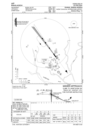
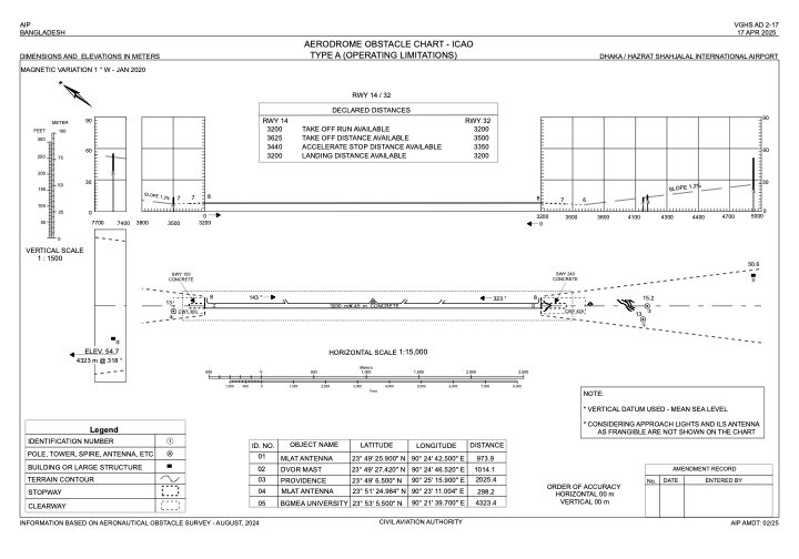


VGHS - Hazrat Shahjalal International Airort, Dhaka
Located in Dhaka, Bangladesh
ICAO - , IATA - DAC
Data provided by AirmateGeneral information
Coordinates: N23°50'36" E90°23'52"
Elevation is 27 feet MSL.
View others Airports in Dhaka Division
Operational data
Special qualification required
Current time UTC:
Current local time:
Communications frequencies: [VIEW]
Runways:
| RWY identifier | QFU | Length (ft) | Width (ft) | Surface | LDA (ft) |
| 14 | 144° | 10499 | 148 | UNK | |
| 32 | 324° | 10499 | 148 | UNK |
Airport contact information
Address: Dhaka Bangladesh