


VRDA - Maafaru International Airport
Located in , Maldives
ICAO - , IATA - NMF
Data provided by AirmateGeneral information
Coordinates: N5°49'7" E73°28'11"
Elevation is 6 feet MSL.
View others Airports in Haa Dhaalu Atoll
Operational data
Special qualification required
Current time UTC:
Current local time:
Communications frequencies: [VIEW]
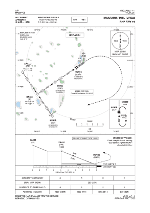
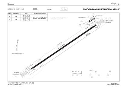
Runways:
| RWY identifier | QFU | Length (ft) | Width (ft) | Surface | LDA (ft) |
| 06 | 56° | 9350 | 148 | UNK | |
| 24 | 236° | 9350 | 148 | UNK |
Airport contact information
Address: Maldives