
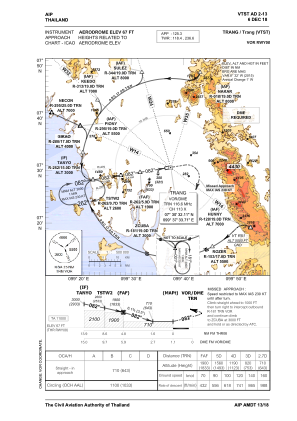
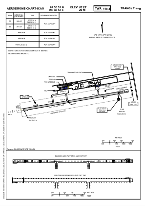


VTST - Trang / Trang Airport
Located in Trang, Thailand
ICAO - VTST, IATA - TST
Data provided by AirmateGeneral information
Coordinates: N7°30'31" E99°36'57"
Elevation is 67 feet MSL.
View others Airports in Trang Province
Operational data
Special qualification required
Current time UTC:
Current local time:
Communications frequencies: [VIEW]
Runways:
| RWY identifier | QFU | Length (ft) | Width (ft) | Surface | LDA (ft) |
| 08 | 81° | 7612 | 148 | ASP | |
| 26 | 261° | 7612 | 148 | ASP |
Airport contact information
Address: Trang Thailand