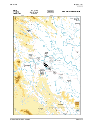


VVTX - Thanh Hoa
Located in Tho Xuan Dom, Viet Nam
ICAO - , IATA -
Data provided by AirmateGeneral information
Coordinates: N19°54'9" E105°28'9"
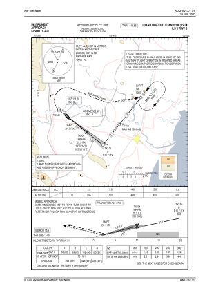
Elevation is 59 feet MSL.
Magnetic variation is -2° East View others Airports in Thanh Hoa
Operational data
Special qualification required
Current time UTC:
Current local time:
Communications frequencies: [VIEW]
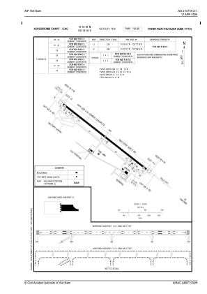
Runways:
| RWY identifier | QFU | Length (ft) | Width (ft) | Surface | LDA (ft) |
| 13 | 129° | 10465 | 157 | CONC | |
| 31 | 309° | 10465 | 157 | CONC |
Airport contact information
Address: Tho Xuan Dom Viet Nam